A team of drone enthusiasts have built a sub-$500 drone that uses a camera and Google Maps to provide itself with GPS co-ordinates, removing the need for a GPS satellite signal. And all of this was done in 24 hours during the El Segundo Defense Tech Hackathon.
$500 drone with no need for a GPS signal
The drone the trio opted for, is a custom designed and 3D printed fixed wing featuring a large single motor towards the rear and a downward facing camera used for geo-referencing.
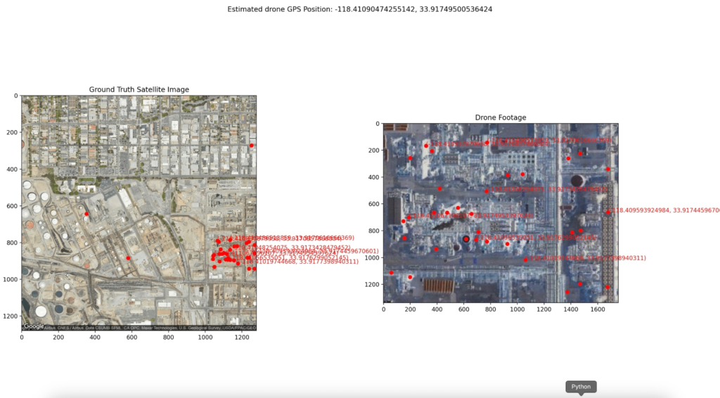
The drone uses a camera mounted underneath it to position itself with imagery from Google Maps highlighting similarities in the images to get a rough estimate of the co-ordinates. Doesn’t Google Maps still require internet, you may ask?
Google Maps allows users to download segments of maps ahead of time, usually for use when you are travelling or camping out in remote areas. In this instance, the team used this feature to their advantage, allowing the drone to continue operating regardless of having a GPS satellite connection.

Why is this exciting?
Without needing to rely on an external constellation of satellites, the GPS-free drone can continue operating on missions in GPS-denied environments, such as remote areas or those that have been jammed. Unlike Skydio’s approach, which uses cameras to position itself, using imagery that doesn’t rely on light to work means this drone can fly anywhere in the world it has imagery for at any time of the day or night.
This obviously has benefits for the defense industry, who are always trying to advance UAV tech and get around enemy defenses. On top of this, the drone costs under $500 to produce and with manufacturing at volume even less.
El Segundo Defense Tech Hackathon
The team built this impressive drone during the El Segundo Defense Tech Hackathon hosted by 8VC, Entrepreneur First, and Apollo Defense in collaboration with the.
The problem set given to the hackathon teams from the U.S. Department of Defense and the National Security Innovation Network (NSIN) focused on counter-UAS, AI/ML, and RF/Electronic Warfare.
Source: X/Twitter


